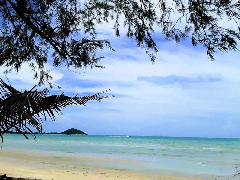
Before it on the ring road
Tong Yang Beach
3.3 km south of Nathon Beach
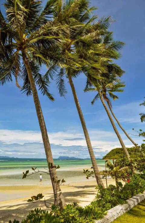
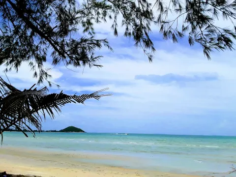
Discover Tong Yang Beach on Koh Samui's west coast: a quiet ~4 km bay with an offshore reef, Five Islands sunset views
Right now
Month by month
Pick a month. The water, the swim call, the crowds and the sun all follow your pick, here and further down the page.
CalmChoppyRough Rain
Walk January
Walk the sand, skip the swim
Not a swimming beach in any month: come for the walk, the view and the shallows at your feet.
West coast Sea 28 °C Sunset 18:18 Calm
Walk February
Walk the sand, skip the swim
Not a swimming beach in any month: come for the walk, the view and the shallows at your feet.
West coast Sea 28.5 °C Sunset 18:29 Calm
Walk March
Walk the sand, skip the swim
Not a swimming beach in any month: come for the walk, the view and the shallows at your feet.
West coast Sea 29 °C Sunset 18:32 Calm
Walk April
Walk the sand, skip the swim
Not a swimming beach in any month: come for the walk, the view and the shallows at your feet.
West coast Sea 30 °C Sunset 18:30 Calm
Walk May
Walk the sand, skip the swim
Not a swimming beach in any month: come for the walk, the view and the shallows at your feet.
West coast Sea 30 °C Sunset 18:33 Choppy
Walk June
Walk the sand, skip the swim
Not a swimming beach in any month: come for the walk, the view and the shallows at your feet.
West coast Sea 30 °C Sunset 18:41 Choppy
Walk July
Walk the sand, skip the swim
Not a swimming beach in any month: come for the walk, the view and the shallows at your feet.
West coast Sea 29.5 °C Sunset 18:45 Choppy
Walk August
Walk the sand, skip the swim
Not a swimming beach in any month: come for the walk, the view and the shallows at your feet.
West coast Sea 29.5 °C Sunset 18:38 Choppy
Walk September
Walk the sand, skip the swim
Not a swimming beach in any month: come for the walk, the view and the shallows at your feet.
West coast Sea 29 °C Sunset 18:21 Choppy
Stay out October
Stay on the sand
Rough water on this coast this month. Watch the flags and keep out of the waves.
West coast Sea 29 °C Sunset 18:03 Rough
Stay out November
Stay on the sand
Rough water on this coast this month. Watch the flags and keep out of the waves.
West coast Sea 29 °C Sunset 17:56 Rough
Walk December
Walk the sand, skip the swim
Not a swimming beach in any month: come for the walk, the view and the shallows at your feet.
West coast Sea 28.5 °C Sunset 18:03 Calm
Swim
Not for swimming
Too shallow, rocky or rough to swim. Come for the walk and the view.
Snorkel
Sea
CalmCalmCalmCalmChoppyChoppyChoppyChoppyChoppyRoughRoughCalm
28 °C water, 125 mm of rain on 8 days.28.5 °C water, 65 mm of rain on 4 days.29 °C water, 115 mm of rain on 5 days.30 °C water, 85 mm of rain on 6 days.30 °C water, 130 mm of rain on 11 days.30 °C water, 135 mm of rain on 10 days.29.5 °C water, 115 mm of rain on 11 days.29.5 °C water, 100 mm of rain on 10 days.29 °C water, 120 mm of rain on 11 days.29 °C water, 295 mm of rain on 16 days.29 °C water, 445 mm of rain on 16 days.28.5 °C water, 265 mm of rain on 12 days.
Calm December to April
Sand
Pale, medium
Firm sand of medium grain, good for walking.
No tidal flats
Crowds
Some company
Peak season on the island: more people on every beach.Peak season on the island: more people on every beach.Shoulder season: a steady trickle of visitors.Shoulder season: a steady trickle of visitors.Low season island-wide. You may have long stretches to yourself.Low season island-wide. You may have long stretches to yourself.Shoulder season: a steady trickle of visitors.Shoulder season: a steady trickle of visitors.Low season island-wide. You may have long stretches to yourself.Low season island-wide. You may have long stretches to yourself.Low season island-wide. You may have long stretches to yourself.Peak season on the island: more people on every beach.
Island busy this month
Sunset
18:1818:2918:3218:3018:3318:4118:4518:3818:2118:0317:5618:03
Goes down over open water, straight out to sea.Goes down over open water, straight out to sea.Goes down over the sea toward the Ang Thong islands, about 25 km out.Goes down over open water, straight out to sea.Goes down over the sea toward the Ang Thong islands, about 24 km out.Goes down over the sea toward the Ang Thong islands, about 24 km out.Goes down over the sea toward the Ang Thong islands, about 24 km out.Goes down over the sea toward the Ang Thong islands, about 24 km out.Goes down over the sea toward the Ang Thong islands, about 25 km out.Goes down over the sea toward the Ang Thong islands, about 25 km out.Goes down over open water, straight out to sea.Goes down over open water, straight out to sea.
Kids
0 of 3
Not one for small children: deep, rough or rocky water.
Kids rating
Food
Bring your own
No restaurant named on the sand. Pack water and snacks.
Village prices
After dark
Nothing
No bars and no lights. For a night out, head to Chaweng or Bophut.
Nightlife rating
The story
16 min read
Key facts
Nathon Beach (also written Na Thon) sits on the west coast of Koh Samui, Thailand, fronting the island’s capital and main port town of the same name. This is not a swimming beach: it is a working waterfront where ferries dock, fishing boats unload, and the whole island’s traffic to the mainland funnels through one strip of piers. Is Nathon worth visiting? Yes for a half day: old Chinese shophouses, a Saturday walking street, local-priced seafood and, by near-universal agreement among locals, the best sunsets on the island. Skip it if you want sand and sunbeds.
Nathon Town developed in the mid-19th century as a fishing settlement founded by Hainanese Chinese migrants and grew into Koh Samui’s administrative and commercial capital. Tourism development later shifted the island’s center of gravity east to Chaweng and Lamai, but Nathon kept the government offices, the main ferry terminal, and a genuinely local atmosphere that the resort beaches lost decades ago. Visitors come here to catch a ferry, buy souvenirs at local prices, eat where Samui residents eat, and watch the sun drop into the Gulf of Thailand over the water.
Samui International Airport is roughly 23.5 km northeast of Nathon, about 35-45 minutes by taxi. Chaweng, the island’s main resort strip, is a similar drive across the interior. Lipa Noi Beach lies about 6 km south along the coastal road, and Maenam Beach is roughly 15 minutes north.
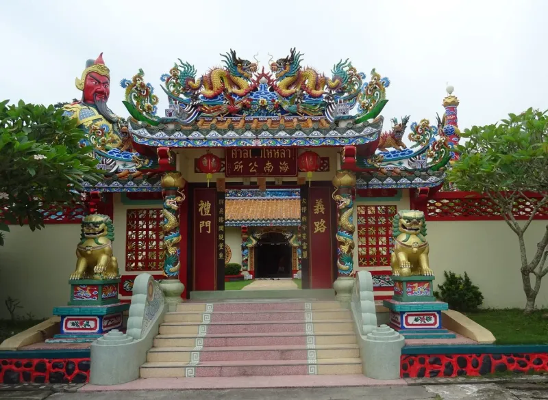
Nathon’s story begins with Chinese migrants from Hainan Island, the first wave of whom settled along the Nathon River in the 1850s, drawn by rich fishing grounds and land suited to coconut cultivation. Coconuts, not tourism, built Samui’s early economy, and Nathon’s natural harbor made it the obvious hub for loading copra and dried coconut onto boats bound for the mainland.
By the mid-19th century, Nathon had become the island’s administrative and commercial capital, a role it held for well over a century. Government offices, the courthouse, and the main hospital were established here, and the town grew a proper grid of streets lined with two- and three-story Chinese shophouses: a mix of homes, warehouses, and shops that still defines the old town today.
When Samui International Airport opened on the northeast coast in the 1980s and mass tourism took hold, the island’s commercial energy shifted toward Chaweng and Lamai. Nathon lost its position as Samui’s busiest town but kept its administrative functions and its port. The result is a town that feels frozen somewhere between the 1970s and today: faded shophouse facades, family-run shops that have operated for generations, and none of the high-rise development that reshaped the east coast.
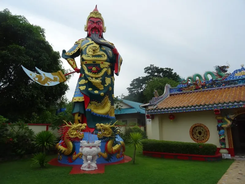
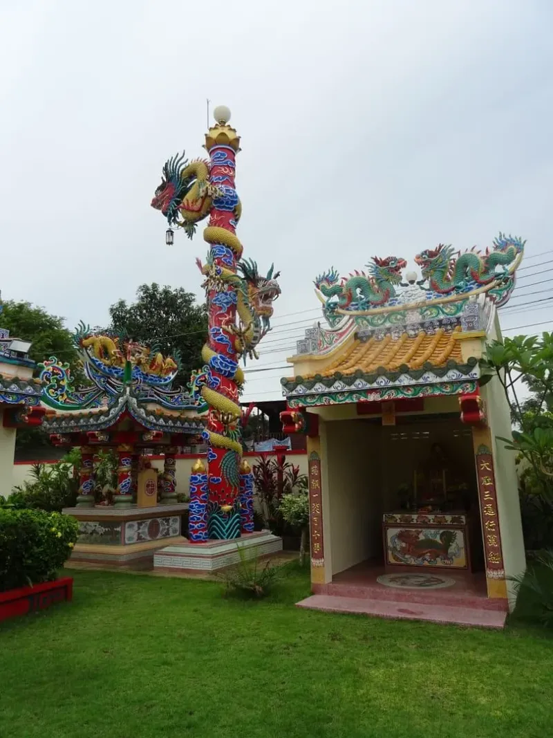
The clearest surviving marker of Nathon’s Hainanese roots is the Nathon Hainan Shrine, a Chinese temple in the old town with ornate architecture and golden lion statues, still the center of community life during Chinese New Year and the Vegetarian Festival. Walking the shrine’s surrounding streets is the closest thing on Koh Samui to stepping into the island’s pre-tourism history.
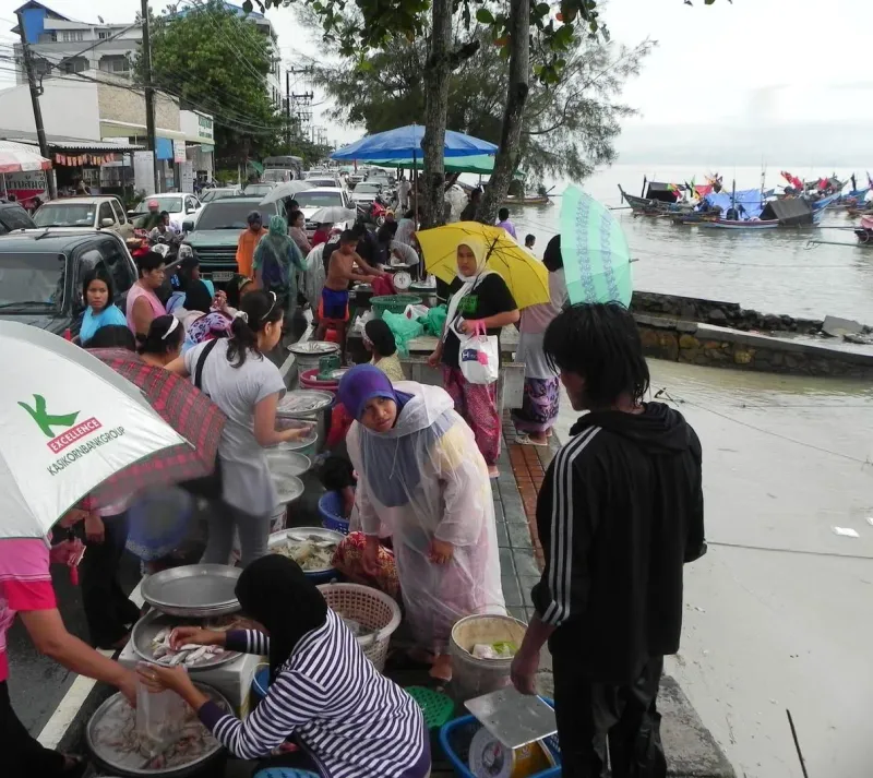
No. Nathon Beach itself is a narrow strip of sand running along the town’s waterfront, more promenade than resort beach. The seabed here is typically murky from ferry traffic, boat fuel, and the natural silt of a working harbor, and there is no meaningful swimming infrastructure: no loungers, no beach bars serving cocktails in the sand, no lifeguards. Locals and guidebooks alike are consistent on this point: Nathon is not where you come to swim.
What the beach does offer is a genuinely pleasant waterfront walk. A paved promenade runs along the sea wall for a stretch of the town, giving views out toward the piers, the fishing fleet, and, on clear days, the silhouette of the mainland’s hills across the Gulf of Thailand. Benches and a handful of small pavilions make it an easy place to sit with a coffee or a bag of street food and watch boats come and go.
If swimming is the priority, Lipa Noi Beach, about 6 km south, offers calmer, cleaner water with a genuine swimming beach and similarly excellent sunsets.
Nathon Town sits directly behind the beach and is arguably the more interesting half of a visit here. Two main parallel streets running along and just behind the waterfront form the commercial spine of the town, lined with old two-story Chinese shophouses: some restored as cafes and boutiques, many still operating as their original grocery stores, tailors, hardware shops, and gold traders.
Shops generally open from around 9 AM to 6-7 PM, though hours vary by owner and many close for an afternoon lull. Most accept cash only; bring baht, as card machines are far less common here than in resort areas. Bargaining is possible in some shops but far less aggressive than at tourist night markets: prices here are largely aimed at locals, not visitors.
Every Saturday evening, a stretch of Nathon’s main road closes to traffic and becomes a walking street market, smaller and more local in character than the well-known Friday market in Bophut’s Fisherman’s Village or the Thursday market in Maenam. Stalls typically open from around 4-5 PM into the evening.
Nathon’s food scene trades style for value. This is where Samui residents, not tour groups, eat, and prices reflect that.
| Type | Price Range | Known For |
|---|---|---|
| Waterfront seafood restaurants | $-$$ | Fresh catch, grilled fish and prawns, harbor views |
| Old-town noodle and rice shops | $ | Pad thai, khao man gai, boat noodles, quick lunches |
| Bakeries and coffee shops | $ | Thai-Chinese bakeries in converted shophouses |
| Saturday market stalls | $ | Street food, grilled skewers, desserts |
Because most of Koh Samui’s popular beaches face north or east toward Koh Phangan and the open Gulf, few offer a genuine sea-level sunset. Nathon’s west-facing waterfront is the exception, and its sunsets are regularly described by locals and long-term residents as the best on the island: a “fiery burnt orange” that colors the sky over the pier and the anchored fishing boats.
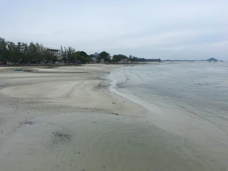
Sunset falls at roughly 6-6:30 PM year-round on Samui, with minor seasonal shifts. Arriving 20-30 minutes early secures a spot on the promenade before the after-work crowd of locals gathers for the same view.
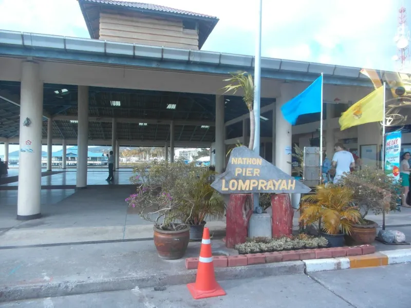
Nathon Pier is Koh Samui’s principal ferry terminal and the busiest transport hub on the island, comprising three separate jetties used by different ferry operators. It is also the tender landing for cruise ships, which anchor offshore because the island has no cruise terminal: see the Koh Samui cruise port guide for shore plans and taxi fares.
Most Ang Thong Marine Park day-trip boats depart from or near Nathon Pier, with hotel pickup around 7-8 AM bringing visitors to the pier before boarding. A typical full-day itinerary includes stops at Ko Wua Talap, Bua Bok Cave, Ko Mae Ko’s Emerald Lake viewpoint, plus snorkeling, kayaking, and beach time, before returning to Nathon Pier around 4-4:30 PM. Tour prices run roughly 1,500-2,500 THB (~43-71 USD), with the national park entrance fee (~300 THB / ~8.50 USD for foreign adults) usually charged separately, per the Department of National Parks. Read more about the marine park’s landscape on our guide to the Ang Thong Emerald Lake hike.
Nathon’s west-coast position puts a mix of cultural and natural sites within a short drive.
Nathon itself has limited accommodation aimed at tourists: most visitors passing through stay elsewhere on the island and treat Nathon as a day visit or transit point. A handful of budget guesthouses and small hotels in the old town serve travelers catching early ferries or those who specifically want to experience local Samui life.
| Category | Average Price | Notes |
|---|---|---|
| Budget guesthouses (Nathon town) | 525-1,225 THB (~15-35 USD)/night | Simple rooms, convenient for early ferry departures |
| Mid-range (nearby Lipa Noi) | 1,750-3,500 THB (~50-100 USD)/night | Beachfront bungalows and small resorts, 10-15 min away |
| Upscale (nearby Taling Ngam / Lipa Noi) | 5,250-10,500+ THB (~150-300+ USD)/night | Sunset-facing resorts along the southwest coast |
Most travelers base themselves in Chaweng, Bophut, Maenam, or Lipa Noi and visit Nathon for the day (for the market, the ferry, or the sunset) rather than sleeping in the town itself.
Nathon is about 23.5 km from the airport, a drive of roughly 35-45 minutes depending on traffic, crossing the island from the northeast corner to the west coast.
Songthaews on the island’s ring road routes pass through Nathon regularly, including the route connecting the airport, Bang Rak, Bophut, Maenam, and Nathon along the north coast. Fares typically run 50-100 THB depending on distance; flag one down along Route 4169.
The old town is small enough to explore entirely on foot: most shops, the shrine, and the piers sit within a 10-15 minute walk of each other. For onward travel around the island, scooters rent for around 200-300 THB/day (~5.50-8.50 USD) and cars for 1,200-1,800 THB/day (~34-51 USD).
| Season | Months | Conditions | Rating |
|---|---|---|---|
| Peak / Dry | Dec - Feb | Sunny, calm seas, best ferry conditions | |
| Hot | Mar - May | Hot (35 degrees Celsius+), generally dry | |
| Inter-monsoon | Jun - Aug | Mixed weather, generally pleasant | |
| Monsoon | Sep - mid-Nov | Rain and rough seas possible, occasional ferry delays |
Arrive at the pier at least 30-45 minutes before departure, especially for mainland-bound ferries during peak season. Luggage storage is limited, so plan transfers accordingly. Toilets and small cafes are available at the pier waiting areas.
Nathon rewards a half-day visit rather than a full one: browse the old-town shops in the late afternoon, eat an early dinner at a waterfront seafood restaurant, watch the sunset from the sea wall, and (if it’s a Saturday) finish at the walking street market.
| Traveler Type | Fit | Why |
|---|---|---|
| Ferry travelers | The island’s main port: essential stop for mainland, Koh Phangan, or Koh Tao connections | |
| Culture seekers | Old Chinese shophouses, the Hainan Shrine, and genuine local life | |
| Budget shoppers | Local prices well below tourist-zone markups | |
| Sunset chasers | The clearest west-facing sunset views on Koh Samui | |
| Swimmers and sunbathers | Not a swimming beach: head to Lipa Noi or Maenam instead | |
| Nightlife seekers | Quiet after dark outside the Saturday market | |
| Day-trippers from other beaches | Easy half-day addition combining shopping, food, and sunset |
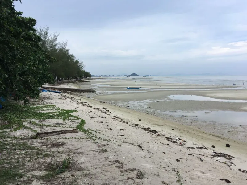
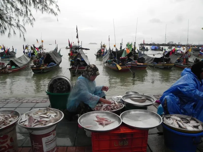
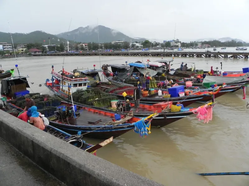
No. Nathon Beach is a working port waterfront, not a swimming beach: the water is affected by ferry and fishing boat traffic and there is no beach infrastructure for sunbathing or swimming. For swimming, head to Lipa Noi Beach about 6 km south or Maenam Beach roughly 15 minutes north, both of which offer calm, clean water.
Yes, as a half-day stop. Nathon offers old Chinese shophouses, the Hainan Shrine, local-priced shopping and seafood, a Saturday evening walking street and west-facing sunsets. It is not a beach destination, so combine it with a swim at Lipa Noi or Maenam.
Nathon Pier is Koh Samui’s main ferry terminal, with three jetties, ticket agencies, small cafes and toilets in the waiting areas. Most visitors come to catch a ferry to Donsak, Koh Phangan or Koh Tao, or to join an Ang Thong Marine Park tour, then stay for the waterfront and old town.
Nathon is Koh Samui’s capital and main port town, home to the island’s principal ferry terminal, several government offices, and its oldest commercial district. Nearly all ferry traffic to the Thai mainland, Koh Phangan, and Koh Tao passes through Nathon Pier, making it the island’s key transport hub.
Every Saturday evening, typically from around 4-5 PM into the night. It is smaller and more local than Bophut’s Friday market or Maenam’s Thursday market, with street food, local produce, and handicrafts aimed more at residents than tourists.
Ferries run from Nathon Pier to Donsak Pier near Surat Thani roughly every hour between 5 AM and 7 PM. The crossing takes about 1.5 hours and costs approximately 200-250 THB (~5.50-7 USD) one-way. Combined ferry-and-bus tickets to Bangkok and other mainland cities are sold at agencies near the pier.
Most Ang Thong National Marine Park day tours depart from or pick up near Nathon Pier, typically between 7-8 AM, and return around 4-4:30 PM. Full-day tours cost roughly 1,500-2,500 THB (~43-71 USD), with the park’s ~300 THB entrance fee usually charged separately.
About 23.5 km, roughly 35-45 minutes by car depending on traffic. A taxi costs approximately 500-650 THB (~14-19 USD). This is a longer transfer than most airport-to-beach routes on Samui, since Nathon sits on the opposite side of the island from the airport.

Nearby
What is near
The nearest temples, waterfalls, hikes and beaches, each with the straight-line distance and direction. Point at a name to find its pin.
Getting hereStraight-line distances to the places most visitors come from.
Sunset
From the sand
Nathon Beach looks north-west. Pick a month to see where the sun meets the horizon, and what stands in front of it.
18:18January18:29February18:32March18:30April18:33May18:41June18:45July18:38August18:21September18:03October17:56November18:03December
Sun bearing from the middle of the beach, computed from its coordinates and the coastline outlines, mid-month.
This coast
Along the ring road
Nathon Beach is No. 1 of 34 round the ring road. Next door: Tong Yang Beach one way, Bang Makham Beach the other.
Route 4169, the ring road, runs behind every beach on this stretch
Before it on the ring road
3.3 km south of Nathon Beach
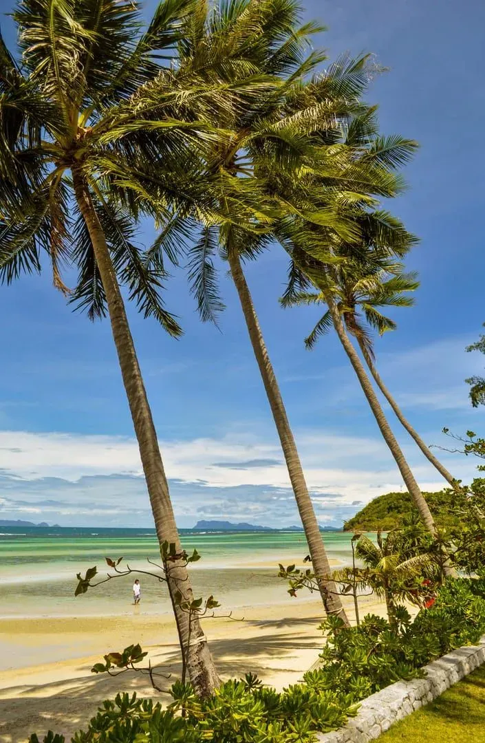
Discover Tong Yang Beach on Koh Samui's west coast: a quiet ~4 km bay with an offshore reef, Five Islands sunset views
After it on the ring road
1.8 km north of Nathon Beach
Bang Makham Beach is a ~2 km tidal fishing shore on Koh Samui's west coast near Nathon: low-tide sand, Ang Thong views, roadside bars.